chitika

Tuesday, March 4, 2014

Himalayas


                        Himalayas


The Himalayas, or Himalaya, (/ˌhɪməˈl.ə/ or /hɪˈmɑːləjə/; Sanskrit, hima (snow) + ālaya (dwelling), literally, "abode of the snow") is a mountain range in Asia separating the plains of the Indian subcontinent from the Tibetan Plateau.
The Himalayan range is home to the planet's highest peaks, including the highest, Mount Everest. The Himalayas include over a hundred mountains exceeding 7,200 metres (23,600 ft) in elevation. By contrast, the highest peak outside Asia – Aconcagua, in the Andes – is 6,961 metres (22,838 ft) tall.The Himalayas have profoundly shaped the cultures of South Asia. Many Himalayan peaks are sacred in both Buddhism and Hinduism.
Besides the Greater Himalayas of these high peaks there are parallel lower ranges. The first foothills, reaching about a thousand meters along the northern edge of the plains, are called the Sivalik Hills or Sub-Himalayan Range. Further north is a higher range reaching two to three thousand meters known as the Lower Himalayan or Mahabharat Range.
The Himalayas abut or cross six countries: Bhutan, India, Nepal, China, Afghanistan and Pakistan, with the first three countries having sovereignty over most of the range.The Himalayas are bordered on the northwest by the Karakoram and Hindu Kush ranges, on the north by the Tibetan Plateau, and on the south by the Indo-Gangetic Plain.
Three of the world's major rivers, the Indus, the Ganges and the Tsangpo-Brahmaputra, all rise near Mount Kailash and cross and encircle the Himalayas. Their combined drainage basin is home to some 600 million people.

 Everest North Face toward Base Camp Tibet Luca Galuzzi 2006 edit 1.jpg  

The Himalaya are among the youngest mountain ranges on the planet and consist mostly of uplifted sedimentary and metamorphic rock. According to the modern theory of plate tectonics, their formation is a result of a continental collision or orogeny along the convergent boundary between the Indo-Australian Plate and the Eurasian Plate. The Arakan Yoma highlands in Myanmar and the Andaman and Nicobar Islands in the Bay of Bengal were also formed as a result of this collision.
During the Upper Cretaceous, about 70 million years ago, the north-moving Indo-Australian Plate was moving at about 15 cm per year. About 50 million years ago, this fast moving Indo-Australian plate had completely closed the Tethys Ocean, the existence of which has been determined by sedimentary rocks settled on the ocean floor, and the volcanoes that fringed its edges. Since both plates were composed of low density continental crust, they were thrust faulted and folded into mountain ranges rather than subducting into the mantle along an oceanic trench.An often-cited fact used to illustrate this process is that the summit of Mount Everest is made of marine limestone from this ancient ocean.
Today, the Indo-Australian plate continues to be driven horizontally below the Tibetan plateau, which forces the plateau to continue to move upwards. The Indo-Australian plate is still moving at 67 mm per year, and over the next 10 million years it will travel about 1,500 km into Asia. About 20 mm per year of the India-Asia convergence is absorbed by thrusting along the Himalaya southern front. This leads to the Himalayas rising by about 5 mm per year, making them geologically active. The movement of the Indian plate into the Asian plate also makes this region seismically active, leading to earthquakes from time to time.

The Himalayas have the third largest deposit of ice and snow in the world, after Antarctica and the Arctic. The Himalayan range encompasses about 15,000 glaciers, which store about 12,000 km3 (3000 cubic miles) of fresh water.Its glaciers include the Gangotri and Yamunotri (Uttarakhand) and Khumbu glaciers (Mount Everest region), and Zemu (Sikkim).
Owing to the mountains' latitude near the Tropic of Cancer, the permanent snow line is among the highest in the world at typically around 5,500 metres (18,000 ft).In contrast, equatorial mountains in New Guinea, the Rwenzoris and Colombia have a snow line some 900 metres (2,950 ft) lower. The higher regions of the Himalayas are snowbound throughout the year, in spite of their proximity to the tropics, and they form the sources of several large perennial rivers, most of which combine into two large river systems:
  • The western rivers combine into the Indus Basin, of which the Indus River is the largest. The Indus begins in Tibet at the confluence of Sengge and Gar rivers and flows southwest through India and then through Pakistan to the Arabian Sea. It is fed by the Jhelum, the Chenab, the Ravi, the Beas, and the Sutlej rivers, among others.
  • Most of the other Himalayan rivers drain the Ganges-Brahmaputra Basin. Its main rivers are the Ganges, the Brahmaputra and the Yamuna, as well as other tributaries. The Brahmaputra originates as the Yarlung Tsangpo River in western Tibet, and flows east through Tibet and west through the plains of Assam. The Ganges and the Brahmaputra meet in Bangladesh, and drain into the Bay of Bengal through the world's largest river delta,the Sunderbans.

Monday, February 17, 2014

Gasherbrum I


                             Gasherbrum I


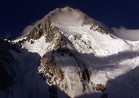
Gasherbrum I (Urdu: گاشر برم -1‎; simplified Chinese:  traditional Chinese: pinyin: Jiāshūěrbùlǔmù I Fēng), also known as Hidden Peak or K5, is the 11th highest peak on Earth, located on the Pakistani–Chinese border in Gilgit–Baltistan region of Pakistan and Xinjiang region of China. Gasherbrum I is part of the Gasherbrum massif, located in the Karakoram region of the Himalaya. Gasherbrum is often claimed to mean "Shining Wall", presumably a reference to the highly visible face of the neighboring peak Gasherbrum IV; but in fact it comes from "rgasha" (beautiful) + "brum" (mountain) in Balti, hence it actually means "beautiful mountain."
Gasherbrum I was designated K5 (meaning the 5th peak of the Karakoram) by T.G. Montgomerie in 1856 when he first spotted the peaks of the Karakoram from more than 200 km away during the Great Trigonometric Survey of India. In 1892, William Martin Conway provided the alternate name, Hidden Peak, in reference to its extreme remoteness.
Gasherbrum I was first climbed on July 5, 1958 by Pete Schoening and Andy Kauffman of an eight-man American expedition led by Nicholas B. Clinch. Richard K. Irvin, Tom Nevison, Tom McCormack, Bob Swift and Gil Roberts were also members of the team.

 HiddenPeak.jpg

Timeline

  • 1934 - A large international expedition, organized by the Swiss G.O. Dyhrenfurth, explores Gasherbrum I and II. Two climbers get to 6,300 m (20,670 ft).
  • 1936 - A French expedition gets to 6,900 m (22,640 ft).
  • 1958 - An American team makes the first ascent.
  • 1975 - Reinhold Messner and Peter Habeler reach the summit on a new route (northwest route) in pure alpine style (first time on an 8000 metre peak) taking 3 days total. One day later, three Austrians from a different expedition led by Hanns Schell reach the summit on the American route.
  • 1977 - The fourth successful ascent by two Slovenians (Nejc Zaplotnik and Andrej Stremfelj), again on a new route.
  • 1980 - A French expedition is successful with the 5th ascent and pass the south ridge for the first time.
  • 1981 - Japanese have the 6th successful ascent.
  • 1982 - G. Sturm, M. Dacher and S. Hupfauer of a German expedition summit via a new route on the north face. In the same year, French Marie-José Valençot is the first woman who reaches the summit. Her husband, Sylvain Saudan from Switzerland performs the first ski descent from the top of an 8000 metre peak to base camp.
  • 1983 - Jerzy Kukuczka with Wojciech Kurtyka, new route. Alpine style ascent without the aid of oxygen.
  • 1983 - Teams from Switzerland and Spain are successful.
  • 1984 - Reinhold Messner and Hans Kammerlander traverse Gasherbrum II and Gasherbrum I without returning to base camp in between
  • 1985 - Solo ascent by Benoît Chamoux. On July 14, the Italian Giampiero Di Federico (solo ascent) opens a new route on the north-west face.
  • 2003 - 19 people reach the summit, 4 deaths, including Mohammad Oraz.
  • 2012 - March 9, Adam Bielecki and Janusz Gołąb made the first winter ascent. The ascent was made without the aid of supplementary oxygen.
The same day, three climbers from a different expedition; Austrian Gerfried Goschl, Swiss Cedric Hahlen and Pakistani mountaineer Nisar Hussain Sadpara, went missing, never to be found again. They were trying to ascend via a new route and are considered to have been blown off by strong winds.


Sunday, February 16, 2014

Mount McKinley Alaska, USA


                     Mount McKinley

                       Alaska, USA

Athabasca Indians tribes call it Denali, meaning the Great in their language. And mount up to its reputation … McKinley is not only the highest mountain in North America, but also a great collector of lives. Among its records include the fact that the king of the mountains of Alaska is bigger even than Everest. Since it is located in northern high latitude to make the atmosphere here to be more rarefied than a 8,000 meter high mountain located hypothetically, somewhere near the equator.
Another bold enemy who dare to conquer it, is ubiquitous frost. Here temperatures are terrible. Winter drops to -60 degrees Celsius and at times windy, the temperature felt by the human body is found on Denali -83 degrees Celsius. Due to high latitudes same risk altitude sickness is very common. For the reasons listed above, mountain climbing success rate reaches only 50% of trials. Many were those who lost the battle: every year, dozens of climbers lose their lives on icy slopes. 2003 was the worst – 100 climbers have died to meet the Great.

Its height is 6194 M:


Mount Fuji, Japan


                      Mount Fuji, Japan

http://www.allaboutravelling.com/wp-content/uploads/2012/10/Mount-Fuji-Japan.jpg  

Mountains should not be treated in play. Despite their beauty, mountains hide deadly dangers even for the best climbers. Even our Carpathians, not giddy heights can be dangerous and deadly traps for those who scorn the mysteries of Iron Mountain and nescotesc rules of incursions into the kingdom of stone and wood. So dozens of dead standing testimony tribute mountains are sacrificed every year. Especially dangerous are found to be the highest and most inaccessible mountains of the planet. These stone giants take their mysterious lives even among the best climbers and mountaineers in the world. If I ever get iron with boot and his climbing rope, be aware not only of grand spectacle that occurs every step, but also the dangers that lurk after every crack of stone and piece of ice.

Its height is about 3776 M.Its looks so beautiful but very dangerous to climb.  Unparalleled mountain, how would the Japanese Talmaci, firm reigns above the capital Tokyo. For millennia, silhouette volcanic cone shaped perfectly, with top whiteness of the snow dressed in ancient lit the imagination of poets, painters and lovers of beauty of the Rising Sun Country. The whole appearance of old mountain, quiet and elevated, Fuji is relentlessly with tourists. Japanese or foreign, the sacred mountain of Japan not forgive at all. Every year, in the period between October and April, dozens of tourists who ignore warnings unconscious authorities die in cliff collapse.
The cause of death is eminently silly. Mount Fuji is famous for the sunrise, which, seen from the heights of his shows beautiful pictures, unique. To get the best possible angle for viewing or photographing, Japanese tourists climb the mountain at night in hopes of finding the best places for sunrise. Like climbing a mountain at night is a reckless act for the uninitiated, many great pictures amateurs find their Prapastiile passed away in the most beautiful mountain in Japan.


Nanga Parbat, Pakistan


                Nanga Parbat, Pakistan

 If Urdu (spoken in Pakistan), Nanga Parbat translates into Mount Blank, because its huge barren rocky heights, well, in the jargon of climbers, hill macabre reputation has earned the “killer people”. Nanga Parbat “offer” in full all the ways a tragic end to his kingdom. Here death lurks around every corner as hade forms and varied: cardiac or pulmonary edema, fatal frostbite, hypothermia, avalanches, physical exhaustion, altitude sickness.
A German expedition in 1930 paid the death of 31 members courage to face Mount Gol. To date, of the 261 climbers who have climbed the tip, 61 have died in the conditions listed above. In 2005, Slovenian climber Tomaz Humar famous, remained isolated for 6 days on an ice wall at a height of 5900 meters, has escaped with his life only because of the intervention lucky Pakistani army, which rescued by a helicopter. Among the latest victims of Italian mountain climber include Karl Unterkircher, which in 2008 fell into a crevasse. A year ago, South Korean climber Go Mi-Sun slid into a ravine due to high winds, when they came down from the mountain after a succesful ascent …

Its height is about  8128 M.its the most dangerous mountain in the world.Many people lost their life by climbing this mountain.


Wednesday, February 12, 2014

K2


                                K2

The Associated Press (AP) and CNN reported about midday UTC that the death toll in the Sunday's accident on K2 has risen to eleven.
Two Dutch climbers have been rescued by helicopter, the AP also said. CNN reports that two of the people killed were climbing up the mountain in an attempt to assist others.
AP says that about two dozen climbers began the accent of K2, the world's second-highest mountain, Friday after the weather had cleared. Climbers are listed as from the Netherlands, South Korea, Italy, Norway, France, Nepal, Serbia, Pakistan and Ireland.
Trouble began on Sunday when several climbers decided to turn back citing rope placement problems. CNN reports the group was climbing in two teams and both were descending from near the summit when an a large chuck of ice fell sweeping three people off the mountain.


The ice triggered an avalanche which caused confusion within the party.
Wilco Van Rooijen, one of the two rescued Dutch climbers, spoke to AP via phone. He blames poor planning in addition to the avalanche.
"Everything was going well to Camp Four, and on summit attempt, everything went wrong," Van Rooijen said.
He told AP that a low-cloud bank caused whiteout on the mountain, but he chose to begin his decent from the area near the summit.
"There was a Korean guy hanging upside down," Van Rooijen told AP. "There was a second Korean guy who held him with a rope but he was also in shock and then a third guy was there also, and they were trying to survive but I had also to survive."
One stranded climber, Marco Confortola, an Italian who spoke with his brother by phone, described the events as hellish.
"Up there it was hell. During the descent, beyond 8,000 meters (26,000 feet), due to the altitude and the exhaustion I even fell asleep in the snow and when I woke up I could not figure out where I was," Confortola told the ANSA news agency.
A helicopter rescue for Confortola had to be delayed due to poor weather. He told his brother that he was able to walk down to the base camp.
CNN reports that this is the deadliest accident on K2 since records were kept in 1939. 66 people — not counting those in the latest incident — have died on the mountain since then.

Tuesday, February 11, 2014

Malika Parbat


                         Malika Parbat


Malika Parbat (Queen of the mountains) (el. 5,290 metres (17,356 ft) is the highest peak in Kaghan Valley, Khyber Pakhtunkhwa, Pakistan about six km south of Lake Saiful Muluk near Ansoo Lake.
The mountain is clearly visible from the popular tourist spot of Lake Saiful Maluk in Kaghan Valley. Malika Parbat is accessible from Naran-Lake Saiful Muluk side and from Batakundi-Dadar Chitta Glacier. There are three summits that forms Malika Parbat, Malika Parbat (North Peak), Malika Parbat Cresta, and Malika Parbat (South Peak). 

 9162-2 Looking up at Malika Parbat.jpg   

The mountain is clearly visible from the popular tourist spot of Lake Saiful Maluk in Kaghan Valley. Malika Parbat is accessible from Naran-Lake Saiful Muluk side and from Batakundi-Dadar Chitta Glacier. There are three summits that forms Malika Parbat, Malika Parbat (North Peak), Malika Parbat Cresta, and Malika Parbat (South Peak).
Imran Junaidi from Pakistan and Jens Simonsen from Denmark climbed the Malika Parbat (North) peak in July, 2012. Imran Junaidi is the first Pakistani to have climbed the North peak. The mountain is considered non-climbable among the local population due to steepness and other mountain hazards.
 
Recently, an expedition of four members led by Ahmed Mujtaba Ali (Pakistan) and including of reported to Summit the Malika Parbat in the month of August 2012.Other members of the expedition were Ahmed Naveed, Kammal Haider, and Saqib Ali. Rashid Butt lost his life while descending down the sheer slopes on South Peak.
This is for the very first time that a couple of expeditions attempted the peak and succeeded in reaching the sky. Malika Parbat is considered to be the most technical peak above 5,000 metres.
There are other peaks which offer considerable climbing difficulty in Siran Basin, Khabanar Valley and Burji Valley, while from Burawai, another cirqua of low peaks is equally good for mountaineering.
 

Tuesday, January 14, 2014

yahoo


 Yahoo! is an American multinational Internet corporation headquartered in Sunnyvale, California. It is globally known for its Web portal, search engine Yahoo Search, and related services, including Yahoo Directory, Yahoo Mail, Yahoo News, Yahoo Finance and many more.this is the most interesting and most developing industry.Yahoo grew rapidly throughout the 1990s. Like many search engines and Web directories, Yahoo added a web portal. As of 1998, Yahoo! was the most popular starting point for web users.


On August 2, 2013, Yahoo Inc. announced the acquisition of social Web browser concern RockMelt. With the acquisition, the RockMelt team, including the concern's CEO Eric Vishria and CTO Tim Howes, will be the part of Yahoo team. As a result, all the RockMelt applications and existing Web services were terminated on August 31.
create an account and earn more
http://getstartedonline.net/?vip=3571

Click here to get Launch Your Product Online