chitika

Tuesday, March 4, 2014

Himalayas


                        Himalayas


The Himalayas, or Himalaya, (/ˌhɪməˈleɪ.ə/ or /hɪˈmɑːləjə/; Sanskrit, hima (snow) + ālaya (dwelling), literally, "abode of the snow") is a mountain range in Asia separating the plains of the Indian subcontinent from the Tibetan Plateau.
The Himalayan range is home to the planet's highest peaks, including the highest, Mount Everest. The Himalayas include over a hundred mountains exceeding 7,200 metres (23,600 ft) in elevation. By contrast, the highest peak outside Asia – Aconcagua, in the Andes – is 6,961 metres (22,838 ft) tall.The Himalayas have profoundly shaped the cultures of South Asia. Many Himalayan peaks are sacred in both Buddhism and Hinduism.
Besides the Greater Himalayas of these high peaks there are parallel lower ranges. The first foothills, reaching about a thousand meters along the northern edge of the plains, are called the Sivalik Hills or Sub-Himalayan Range. Further north is a higher range reaching two to three thousand meters known as the Lower Himalayan or Mahabharat Range.
The Himalayas abut or cross six countries: Bhutan, India, Nepal, China, Afghanistan and Pakistan, with the first three countries having sovereignty over most of the range.The Himalayas are bordered on the northwest by the Karakoram and Hindu Kush ranges, on the north by the Tibetan Plateau, and on the south by the Indo-Gangetic Plain.
Three of the world's major rivers, the Indus, the Ganges and the Tsangpo-Brahmaputra, all rise near Mount Kailash and cross and encircle the Himalayas. Their combined drainage basin is home to some 600 million people.

 Everest North Face toward Base Camp Tibet Luca Galuzzi 2006 edit 1.jpg  

The Himalaya are among the youngest mountain ranges on the planet and consist mostly of uplifted sedimentary and metamorphic rock. According to the modern theory of plate tectonics, their formation is a result of a continental collision or orogeny along the convergent boundary between the Indo-Australian Plate and the Eurasian Plate. The Arakan Yoma highlands in Myanmar and the Andaman and Nicobar Islands in the Bay of Bengal were also formed as a result of this collision.
During the Upper Cretaceous, about 70 million years ago, the north-moving Indo-Australian Plate was moving at about 15 cm per year. About 50 million years ago, this fast moving Indo-Australian plate had completely closed the Tethys Ocean, the existence of which has been determined by sedimentary rocks settled on the ocean floor, and the volcanoes that fringed its edges. Since both plates were composed of low density continental crust, they were thrust faulted and folded into mountain ranges rather than subducting into the mantle along an oceanic trench.An often-cited fact used to illustrate this process is that the summit of Mount Everest is made of marine limestone from this ancient ocean.
Today, the Indo-Australian plate continues to be driven horizontally below the Tibetan plateau, which forces the plateau to continue to move upwards. The Indo-Australian plate is still moving at 67 mm per year, and over the next 10 million years it will travel about 1,500 km into Asia. About 20 mm per year of the India-Asia convergence is absorbed by thrusting along the Himalaya southern front. This leads to the Himalayas rising by about 5 mm per year, making them geologically active. The movement of the Indian plate into the Asian plate also makes this region seismically active, leading to earthquakes from time to time.

The Himalayas have the third largest deposit of ice and snow in the world, after Antarctica and the Arctic. The Himalayan range encompasses about 15,000 glaciers, which store about 12,000 km3 (3000 cubic miles) of fresh water.Its glaciers include the Gangotri and Yamunotri (Uttarakhand) and Khumbu glaciers (Mount Everest region), and Zemu (Sikkim).
Owing to the mountains' latitude near the Tropic of Cancer, the permanent snow line is among the highest in the world at typically around 5,500 metres (18,000 ft).In contrast, equatorial mountains in New Guinea, the Rwenzoris and Colombia have a snow line some 900 metres (2,950 ft) lower. The higher regions of the Himalayas are snowbound throughout the year, in spite of their proximity to the tropics, and they form the sources of several large perennial rivers, most of which combine into two large river systems:
  • The western rivers combine into the Indus Basin, of which the Indus River is the largest. The Indus begins in Tibet at the confluence of Sengge and Gar rivers and flows southwest through India and then through Pakistan to the Arabian Sea. It is fed by the Jhelum, the Chenab, the Ravi, the Beas, and the Sutlej rivers, among others.
  • Most of the other Himalayan rivers drain the Ganges-Brahmaputra Basin. Its main rivers are the Ganges, the Brahmaputra and the Yamuna, as well as other tributaries. The Brahmaputra originates as the Yarlung Tsangpo River in western Tibet, and flows east through Tibet and west through the plains of Assam. The Ganges and the Brahmaputra meet in Bangladesh, and drain into the Bay of Bengal through the world's largest river delta,the Sunderbans.

Monday, February 17, 2014

Gasherbrum I


                             Gasherbrum I


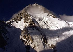
Gasherbrum I (Urdu: گاشر برم -1‎; simplified Chinese:  traditional Chinese: pinyin: Jiāshūěrbùlǔmù I Fēng), also known as Hidden Peak or K5, is the 11th highest peak on Earth, located on the Pakistani–Chinese border in Gilgit–Baltistan region of Pakistan and Xinjiang region of China. Gasherbrum I is part of the Gasherbrum massif, located in the Karakoram region of the Himalaya. Gasherbrum is often claimed to mean "Shining Wall", presumably a reference to the highly visible face of the neighboring peak Gasherbrum IV; but in fact it comes from "rgasha" (beautiful) + "brum" (mountain) in Balti, hence it actually means "beautiful mountain."
Gasherbrum I was designated K5 (meaning the 5th peak of the Karakoram) by T.G. Montgomerie in 1856 when he first spotted the peaks of the Karakoram from more than 200 km away during the Great Trigonometric Survey of India. In 1892, William Martin Conway provided the alternate name, Hidden Peak, in reference to its extreme remoteness.
Gasherbrum I was first climbed on July 5, 1958 by Pete Schoening and Andy Kauffman of an eight-man American expedition led by Nicholas B. Clinch. Richard K. Irvin, Tom Nevison, Tom McCormack, Bob Swift and Gil Roberts were also members of the team.

 HiddenPeak.jpg

Timeline

  • 1934 - A large international expedition, organized by the Swiss G.O. Dyhrenfurth, explores Gasherbrum I and II. Two climbers get to 6,300 m (20,670 ft).
  • 1936 - A French expedition gets to 6,900 m (22,640 ft).
  • 1958 - An American team makes the first ascent.
  • 1975 - Reinhold Messner and Peter Habeler reach the summit on a new route (northwest route) in pure alpine style (first time on an 8000 metre peak) taking 3 days total. One day later, three Austrians from a different expedition led by Hanns Schell reach the summit on the American route.
  • 1977 - The fourth successful ascent by two Slovenians (Nejc Zaplotnik and Andrej Stremfelj), again on a new route.
  • 1980 - A French expedition is successful with the 5th ascent and pass the south ridge for the first time.
  • 1981 - Japanese have the 6th successful ascent.
  • 1982 - G. Sturm, M. Dacher and S. Hupfauer of a German expedition summit via a new route on the north face. In the same year, French Marie-José Valençot is the first woman who reaches the summit. Her husband, Sylvain Saudan from Switzerland performs the first ski descent from the top of an 8000 metre peak to base camp.
  • 1983 - Jerzy Kukuczka with Wojciech Kurtyka, new route. Alpine style ascent without the aid of oxygen.
  • 1983 - Teams from Switzerland and Spain are successful.
  • 1984 - Reinhold Messner and Hans Kammerlander traverse Gasherbrum II and Gasherbrum I without returning to base camp in between
  • 1985 - Solo ascent by Benoît Chamoux. On July 14, the Italian Giampiero Di Federico (solo ascent) opens a new route on the north-west face.
  • 2003 - 19 people reach the summit, 4 deaths, including Mohammad Oraz.
  • 2012 - March 9, Adam Bielecki and Janusz Gołąb made the first winter ascent. The ascent was made without the aid of supplementary oxygen.
The same day, three climbers from a different expedition; Austrian Gerfried Goschl, Swiss Cedric Hahlen and Pakistani mountaineer Nisar Hussain Sadpara, went missing, never to be found again. They were trying to ascend via a new route and are considered to have been blown off by strong winds.


Sunday, February 16, 2014

Mount McKinley Alaska, USA


                     Mount McKinley

                       Alaska, USA

Athabasca Indians tribes call it Denali, meaning the Great in their language. And mount up to its reputation … McKinley is not only the highest mountain in North America, but also a great collector of lives. Among its records include the fact that the king of the mountains of Alaska is bigger even than Everest. Since it is located in northern high latitude to make the atmosphere here to be more rarefied than a 8,000 meter high mountain located hypothetically, somewhere near the equator.
Another bold enemy who dare to conquer it, is ubiquitous frost. Here temperatures are terrible. Winter drops to -60 degrees Celsius and at times windy, the temperature felt by the human body is found on Denali -83 degrees Celsius. Due to high latitudes same risk altitude sickness is very common. For the reasons listed above, mountain climbing success rate reaches only 50% of trials. Many were those who lost the battle: every year, dozens of climbers lose their lives on icy slopes. 2003 was the worst – 100 climbers have died to meet the Great.

Its height is 6194 M:


Mount Fuji, Japan


                      Mount Fuji, Japan

http://www.allaboutravelling.com/wp-content/uploads/2012/10/Mount-Fuji-Japan.jpg  

Mountains should not be treated in play. Despite their beauty, mountains hide deadly dangers even for the best climbers. Even our Carpathians, not giddy heights can be dangerous and deadly traps for those who scorn the mysteries of Iron Mountain and nescotesc rules of incursions into the kingdom of stone and wood. So dozens of dead standing testimony tribute mountains are sacrificed every year. Especially dangerous are found to be the highest and most inaccessible mountains of the planet. These stone giants take their mysterious lives even among the best climbers and mountaineers in the world. If I ever get iron with boot and his climbing rope, be aware not only of grand spectacle that occurs every step, but also the dangers that lurk after every crack of stone and piece of ice.

Its height is about 3776 M.Its looks so beautiful but very dangerous to climb.  Unparalleled mountain, how would the Japanese Talmaci, firm reigns above the capital Tokyo. For millennia, silhouette volcanic cone shaped perfectly, with top whiteness of the snow dressed in ancient lit the imagination of poets, painters and lovers of beauty of the Rising Sun Country. The whole appearance of old mountain, quiet and elevated, Fuji is relentlessly with tourists. Japanese or foreign, the sacred mountain of Japan not forgive at all. Every year, in the period between October and April, dozens of tourists who ignore warnings unconscious authorities die in cliff collapse.
The cause of death is eminently silly. Mount Fuji is famous for the sunrise, which, seen from the heights of his shows beautiful pictures, unique. To get the best possible angle for viewing or photographing, Japanese tourists climb the mountain at night in hopes of finding the best places for sunrise. Like climbing a mountain at night is a reckless act for the uninitiated, many great pictures amateurs find their Prapastiile passed away in the most beautiful mountain in Japan.


Nanga Parbat, Pakistan


                Nanga Parbat, Pakistan

 If Urdu (spoken in Pakistan), Nanga Parbat translates into Mount Blank, because its huge barren rocky heights, well, in the jargon of climbers, hill macabre reputation has earned the “killer people”. Nanga Parbat “offer” in full all the ways a tragic end to his kingdom. Here death lurks around every corner as hade forms and varied: cardiac or pulmonary edema, fatal frostbite, hypothermia, avalanches, physical exhaustion, altitude sickness.
A German expedition in 1930 paid the death of 31 members courage to face Mount Gol. To date, of the 261 climbers who have climbed the tip, 61 have died in the conditions listed above. In 2005, Slovenian climber Tomaz Humar famous, remained isolated for 6 days on an ice wall at a height of 5900 meters, has escaped with his life only because of the intervention lucky Pakistani army, which rescued by a helicopter. Among the latest victims of Italian mountain climber include Karl Unterkircher, which in 2008 fell into a crevasse. A year ago, South Korean climber Go Mi-Sun slid into a ravine due to high winds, when they came down from the mountain after a succesful ascent …

Its height is about  8128 M.its the most dangerous mountain in the world.Many people lost their life by climbing this mountain.


Wednesday, February 12, 2014

K2


                                K2

The Associated Press (AP) and CNN reported about midday UTC that the death toll in the Sunday's accident on K2 has risen to eleven.
Two Dutch climbers have been rescued by helicopter, the AP also said. CNN reports that two of the people killed were climbing up the mountain in an attempt to assist others.
AP says that about two dozen climbers began the accent of K2, the world's second-highest mountain, Friday after the weather had cleared. Climbers are listed as from the Netherlands, South Korea, Italy, Norway, France, Nepal, Serbia, Pakistan and Ireland.
Trouble began on Sunday when several climbers decided to turn back citing rope placement problems. CNN reports the group was climbing in two teams and both were descending from near the summit when an a large chuck of ice fell sweeping three people off the mountain.


The ice triggered an avalanche which caused confusion within the party.
Wilco Van Rooijen, one of the two rescued Dutch climbers, spoke to AP via phone. He blames poor planning in addition to the avalanche.
"Everything was going well to Camp Four, and on summit attempt, everything went wrong," Van Rooijen said.
He told AP that a low-cloud bank caused whiteout on the mountain, but he chose to begin his decent from the area near the summit.
"There was a Korean guy hanging upside down," Van Rooijen told AP. "There was a second Korean guy who held him with a rope but he was also in shock and then a third guy was there also, and they were trying to survive but I had also to survive."
One stranded climber, Marco Confortola, an Italian who spoke with his brother by phone, described the events as hellish.
"Up there it was hell. During the descent, beyond 8,000 meters (26,000 feet), due to the altitude and the exhaustion I even fell asleep in the snow and when I woke up I could not figure out where I was," Confortola told the ANSA news agency.
A helicopter rescue for Confortola had to be delayed due to poor weather. He told his brother that he was able to walk down to the base camp.
CNN reports that this is the deadliest accident on K2 since records were kept in 1939. 66 people — not counting those in the latest incident — have died on the mountain since then.

Tuesday, February 11, 2014

Malika Parbat


                         Malika Parbat


Malika Parbat (Queen of the mountains) (el. 5,290 metres (17,356 ft) is the highest peak in Kaghan Valley, Khyber Pakhtunkhwa, Pakistan about six km south of Lake Saiful Muluk near Ansoo Lake.
The mountain is clearly visible from the popular tourist spot of Lake Saiful Maluk in Kaghan Valley. Malika Parbat is accessible from Naran-Lake Saiful Muluk side and from Batakundi-Dadar Chitta Glacier. There are three summits that forms Malika Parbat, Malika Parbat (North Peak), Malika Parbat Cresta, and Malika Parbat (South Peak). 

 9162-2 Looking up at Malika Parbat.jpg   

The mountain is clearly visible from the popular tourist spot of Lake Saiful Maluk in Kaghan Valley. Malika Parbat is accessible from Naran-Lake Saiful Muluk side and from Batakundi-Dadar Chitta Glacier. There are three summits that forms Malika Parbat, Malika Parbat (North Peak), Malika Parbat Cresta, and Malika Parbat (South Peak).
Imran Junaidi from Pakistan and Jens Simonsen from Denmark climbed the Malika Parbat (North) peak in July, 2012. Imran Junaidi is the first Pakistani to have climbed the North peak. The mountain is considered non-climbable among the local population due to steepness and other mountain hazards.
 
Recently, an expedition of four members led by Ahmed Mujtaba Ali (Pakistan) and including of reported to Summit the Malika Parbat in the month of August 2012.Other members of the expedition were Ahmed Naveed, Kammal Haider, and Saqib Ali. Rashid Butt lost his life while descending down the sheer slopes on South Peak.
This is for the very first time that a couple of expeditions attempted the peak and succeeded in reaching the sky. Malika Parbat is considered to be the most technical peak above 5,000 metres.
There are other peaks which offer considerable climbing difficulty in Siran Basin, Khabanar Valley and Burji Valley, while from Burawai, another cirqua of low peaks is equally good for mountaineering.
 

Tuesday, January 14, 2014

yahoo


 Yahoo! is an American multinational Internet corporation headquartered in Sunnyvale, California. It is globally known for its Web portal, search engine Yahoo Search, and related services, including Yahoo Directory, Yahoo Mail, Yahoo News, Yahoo Finance and many more.this is the most interesting and most developing industry.Yahoo grew rapidly throughout the 1990s. Like many search engines and Web directories, Yahoo added a web portal. As of 1998, Yahoo! was the most popular starting point for web users.


On August 2, 2013, Yahoo Inc. announced the acquisition of social Web browser concern RockMelt. With the acquisition, the RockMelt team, including the concern's CEO Eric Vishria and CTO Tim Howes, will be the part of Yahoo team. As a result, all the RockMelt applications and existing Web services were terminated on August 31.
create an account and earn more
http://getstartedonline.net/?vip=3571

Click here to get Launch Your Product Online

Thursday, November 28, 2013

THE KILLER MOUNTAIN

        
             THE KILLER MOUNTAIN

The 2008 K2 disaster occurred on 1 August 2008, when eleven mountaineers from international expeditions died on K2, the second-highest mountain on Earth.Three others were seriously injured. It was the worst single accident in the history of K2 mountaineering.

Climbing on K2 since the disaster:

The summit of K2 was not reached again until 23 August 2011, when Gerlinde Kaltenbrunner (Austria, 14th eight-thousander), Maxut Zhumayev and Vassiliy Pivtsov (Kazakhstan, both 14th eight-thousander) and Darek Zaluski (Poland) topped out K2 via the North Pillar.There were no summits in 2009 and 2010, during which season renowned skier Fredrik Ericsson fell to his death in the bottleneck. According to AdventureStats, the last 17 fatalities on K2 have all occurred in, around or above the bottleneck, once again proving the deadly nature of K2's upper slopes.

The Sherpas and Pakistani high-altitude porters (HAPs) started to prepare fixed lines upwards before midnight. They were joined by Spanish climber Alberto Zerain who had come up from camp III during the night and decided to continue his summit push rather than stay at camp IV. However, the most experienced HAP, Shaheen Baig (from the Serbian team), had to go back down with symptoms of high altitude sickness. His experience was missed and in the confusion, ropes may have been left behind or placed too far to the right side of the Bottleneck.
When the groups started upward at 3 a.m., the Sherpas and HAPs had prepared lines from the shoulder, where they were not needed, up into the Bottleneck (a steep couloir–a gully–leading to the summit slopes), and then had run out of rope for the traverse just above the bottleneck. This forced them to take rope from the lower portion of the route and use it to prepare the lines above the Bottleneck, causing an unplanned delay. At this point the American group decided to abort the attempt and return to the lower camp. It should be noted though, that traditionally, the Bottleneck and ensuing traverse were climbed without fixed ropes. It has been suggested[by whom?] that the climbers of the 2008 K2 summer season were perhaps depending too much on the fixed ropes.
At 8 a.m. people were advancing through the Bottleneck. Dren Mandić decided to attend to his oxygen system and so unclipped the rope to let other climbers pass. Mandić lost his balance and fell, bumping into Cecilie Skog. She was still clipped to the rope and was only knocked over. Mandić however, fell over 100 m down the bottleneck. Some climbers claimed that he was still moving after the fall. People in Camp IV saw the fall and sent a group to help recover his injured or dead body. Swede Fredrik Sträng stated he took command of the recovery operation.
When Sträng reached the body, Serbian climbers Predrag Zagorac and Iso Planic and their HAP Mohammed Hussein had already arrived. They had found no pulse and judging by the severity of his injuries, Mandić was pronounced dead. The Serbian climbers decided to lower the body down to camp IV and Sträng assisted them. They were joined by HAP Jehan Baig (from the French-led independent expedition). He had fulfilled his assisting duties and had been allowed to head down. Several people later indicated he may have been suffering from high altitude sickness, since he had displayed questionable behaviour in abseiling down the bottleneck. Sträng also noticed that he was incoherent, first offering to help in the rescue, later refusing to help, only to return moments later to assist them again. Jehan Baig lost his footing, bumping into Sträng who then urged him to let go of the rope attached to Mandić harness, before all four climbers would be dragged down. Baig finally let go of the rope, but to Sträng and the others' surprise, he did not try to stop his slide by using the self-arrest technique. Jehan Baig fell to his death. It is unclear why he did not try to stop his slide. Sträng decided to descend without the body of Mandić. The Serbian group wrapped the body of Mandić in a flag and fastened him to the mountain before aborting and starting to descend.
These delays, together with the traffic jam in the Bottleneck, resulted in most people reaching the summit much later than planned, some as late as 8 p.m. (the typical time for summiting being between 3 p.m. and 5 p.m.). All together, 18 people summited that day. On the descent, the Spaniard Alberto Zerain, who had topped out first and alone at 3 p.m., managed to pass through the Bottleneck without trouble. But at 8:30 p.m. when the Norwegian group — including Lars Flatø Nessa and Cecilie Skog who reached the summit two hours later than Zerain — had almost negotiated the traverse leading to the Bottleneck, a serac (a large block of ice) broke off from the ice field above. As it fell, it cut all the fixed lines and took with it Rolf Bae (Cecilie Skog's husband), who had abandoned the attempt only 100 m below the summit and was descending at the front of the group. Lars and Cecilie continued descending without the fixed lines and managed to reach Camp IV during the night.
As a result of the serac fall, the climb in the Bottleneck became steeper and more technical. Chunks of ice lay scattered around the route, and the mountaineers above were stranded in the so-called death zone above 8000 meters.Since the climbers were counting on the fixed lines, they were not carrying additional ropes and fall protection devices, forcing the climbers to "free climb" the descent through the notorious Bottleneck. There were still multiple climbers above the Bottleneck, and according to Dutch mountaineer Wilco van Rooijen, panic broke out among them. Some tried to descend in the darkness, while others decided to bivouac and wait until morning before descending.
Pemba Gyalje descended in the darkness without fixed ropes and reached the Camp IV before midnight. Sherpa Chhiring Dorje also free-climbed the Bottleneck with "little" Pasang Lama (who had been stranded without an ice axe) secured to his harness. "I can just about imagine how you might pull it off," writes Ed Viesturs in K2: Life and Death on the World's Most Dangerous Mountain. "You kick each foot in solid, plant the axe, then tell the other guy to kick with his own feet and punch holds with his hands. Don't move until he's secure. Still, if Pasang had come off [i.e. 'fallen'], he probably would have taken Chhiring with him. Talk about selfless!"
Two members of the Korean expedition, Kim Jae-soo and Go Mi-Young, also managed to navigate the bottleneck in the dark, although the latter had to be helped by two Sherpas from the Korean B team, Chhiring Bhote and "Big" Pasang Bhote, who were supposed to summit the next morning. The men had climbed up around midnight with food and oxygen and found Go Mi-Young stranded somewhere in the Bottleneck, unsure of which route she had to take. They guided her down safely.
Meanwhile, Dutchman Cas van de Gevel and Frenchman Hugues D’Aubarede had also decided to manoeuvre the bottleneck in the dark. As he reached the bottom of the Bottleneck, Cas van de Gevel witnessed a climber falling to his death, a story corroborated by the two Sherpas Chhiring Bhote and "big" Pasang Bhote, who also had witnessed one or two objects falling from the mountain. This climber was likely Hugues D'Aubarede, whom van de Gevel had passed just above the Bottleneck in the dark on the way down. D'Aubarede had run out of bottled oxygen hours before, and when van de Gevel had passed him, he had looked tired and insisted van de Gevel descend before him.
Marco Confortola, Wilco van Rooijen and Gerard McDonnell bivouacked above the traverse, as they could not find the fixed ropes leading across the traverse. Confortola claimed that during the bivouac, he heard screams and saw headlights disappear below him after a roaring sound came from the serac field. At that point, 8 people were still above the Bottleneck, stranded in the death zone.

List of fatalities:

Name Nationality Location of death Cause of death
Dren Mandić  Serbia Below the Bottleneck Fell during the ascent
Jehan Baig  Pakistan Fell while trying to recover Dren Mandić's corpse
Rolf Bae  Norway Bottleneck The first serac fall
Hugues D’Aubarede  France Above the Bottleneck Fell in descent during the night
Karim Meherban  Pakistan Either the second serac fall or the third serac fall.
Gerard McDonnell†  Ireland After helping the injured Koreans, he was hit by either the second or third serac fall.
Kyeong-Hyo Park  South Korea Above the Bottleneck The fourth serac fall
Hyo-Gyeong Kim  South Korea
Dong-Jin Hwang  South Korea
Jumik Bhote    Nepal
Pasang Bhote    Nepal

Click here to get Launch Your Product Online

THE HIGHEST MOUNTAIN

                      K2 THE HIGHEST MOUNTAIN   
                       IN THE WORLD


The name K2 is derived from the notation used by the Great Trigonometric Survey. Thomas Montgomerie made the first survey of the Karakoram from Mount Haramukh, some 210 km (130 miles) to the south, and sketched the two most prominent peaks, labelling them K1 and K2.

Geographical setting:

:File:K2-Animation 280611 DLR-Logo 320x240.ogv
 
K2 lies in the northwestern Karakoram Range. It is located in the Baltistan region of Gilgit–Baltistan, Pakistan and the Taxkorgan Tajik Autonomous County of Xinjiang, China. The Tarim sedimentary basin borders the range on the north and the Lesser Himalayas on the south. Melt waters from vast glaciers, such as those south and east of K2, feed agriculture in the valleys and contribute significantly to the regional fresh-water supply. The Karakoram Range lies along the southern edge of the Eurasian tectonic plate and is made up of ancient sedimentary rocks (more than 390 million years old). Those strata were folded and thrust-faulted, and granite masses were intruded, when the Indian plate collided with Eurasia, beginning more than 100 million years ago.The mountain was first surveyed by a European survey team in 1856. Thomas Montgomerie was the member of the team who designated it "K2" for being the second peak of the Karakoram range. The other peaks were originally named K1, K3, K4 and K5, but were eventually renamed Masherbrum, Gasherbrum IV, Gasherbrum II and Gasherbrum I respectively. In 1892, Martin Conway led a British expedition that reached "Concordia" on the Baltoro Glacier.

Climbing routes and difficulties

There are a number of routes on K2, of somewhat different character, but they all share some key difficulties. First, is the extreme high altitude and resulting lack of oxygen: there is only one-third as much oxygen available to a climber on the summit of K2 as there is at sea level.[42] Second is the propensity of the mountain to experience extreme storms of several days' duration, which have resulted in many of the deaths on the peak. Third is the steep, exposed, and committing nature of all routes on the mountain, which makes retreat more difficult, especially during a storm. Despite many attempts there have been no successful winter ascents. All major climbing routes lie on the Pakistani side, which is also where the base camp is located.

Abruzzi Spur:

The standard route of ascent, used far more than any other route, is the Abruzzi Spur, located on the Pakistani side, first attempted by Luigi Amedeo, Duke of the Abruzzi in 1909. This is the southeast ridge of the peak, rising above the Godwin Austen Glacier. The spur proper begins at an altitude of 5,400 metres (17,700 ft), where Advanced Base Camp is usually placed. The route follows an alternating series of rock ribs, snow/ice fields, and some technical rock climbing on two famous features, "House's Chimney" and the "Black Pyramid." Above the Black Pyramid, dangerously exposed and difficult to navigate slopes lead to the easily visible "Shoulder", and thence to the summit. The last major obstacle is a narrow couloir known as the "Bottleneck", which places climbers dangerously close to a wall of seracs which form an ice cliff to the east of the summit. It was partly due to the collapse of one of these seracs around 2001 that no climbers summitted the peak in 2002 and 2003.


Use of bottled oxygen:

For most of its climbing history, K2 was not usually climbed with bottled oxygen, and small, relatively lightweight teams were the norm.However the 2004 season saw a great increase in the use of oxygen: 28 of 47 summitteers used oxygen in that year.

create an account by clicking this link and learn more
http://getstartedonline.net/?vip=3571


Click here to get Launch Your Product Online

K2


  K2


K2 IS THE MOST DANGEROUS MOUNTAIN IN THE WORLD .K2 IS LOCATED IN PAKISTAN. THE BEAUTY OF THIS MOUNTAIN IS SEEN BY MOST OF THE VISITORS. 


create an account an learn more
http://getstartedonline.net/?vip=3571